Wednesday, 29 July 2015

Dark Lane .... Again!

We love Dark Lane near Carisbrooke Castle so decided to head that way today, planning to follow the Shepherd's Trail to Gatcombe and then back toward the castle. This sounded lovely, not too difficult as we were out of practice, and incorporated a picnic. Perfect, yes?
 
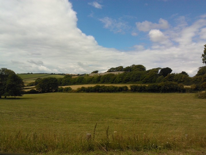
Well, no as it happened. My dodgy navigational skills came to the fore. We left the car park opposite Carisbrooke Priory and proceeded along the road for a couple of minutes before turning onto the Shepherd's Trail. We headed up the path and soon entered Dark Lane, a sunken lane between high chalk banks covered in ferns, ivy,  and herb Robert, and topped with oak, elder and hazel. Lovely and cool and quiet on a summer's day. The path had been scoured by a recent rain storm and glowed white in the shade. The lane came out next to a wheat field, glowing in the sunshine and rattling in the breeze. So far, so good.
 
The path continued clearly for a while longer, before coming to a crossroads. Now. I thought the path continued straight on to the right of the hedge, while teenager thought it went to the left. I assumed I was correct, of course, and we carried on downhill, through a field of sweetcorn as there seemed to be a path through it rather than round the edge. The sweetcorn petered out and we came to a meadow, waist high in flowering grasses, wildflowers and thistles. We carried straight on and realised there was no escape at the bottom of the field. OK, thought I, we'll follow the edge of the field until we get out. We waded through the grass, disturbing hundreds of grasshoppers, and avoiding nettles and thistles, but could find no escape. We continued, and ended up back at the sweetcorn plantation, so found a pathway between towering plants, so we could avoid the pickles, and eventually came to a lane and escaped. Phew! We looked at the map, carefully, turned right and continued until we found another lane. We turned up there, and followed it until it joined up with the Shepherd's Trail again, and were soon plunging down Dark Lane again.
 
Back at the car we noticed a sign for a tea garden at Carisbrooke Priory opposite, so decided that a brew was needed and headed across. The Priory is a former Benedictine Convent that is now looked after by a trust (I think). I got a pot of tea for one for a quid, and got two nice cups of tea out of it, and teenager had a pleasant lemonade. We then had a quick stroll around the walled garden, admired the dovecot, had a peek at the book and produce stalls then went home.
 
We'll try that walk another day.....
 
 
View towards Carisbrooke Castle

Wheat Field

Carisbrooke Priory

Monday, 6 July 2015

Nyman's Gardens

Mother and I ventured to the north island in June, and headed to West Sussex and a visit to Nyman's. We stopped off at Amberly and had lunch in a pleasant pub by the river. Enormous portions and we didn't need to eat for the remainder of the day!
 
Nyman's was everything I hoped for. From the moment we got into the car park, there were magnificent trees, most notably a type of weeping conifer. I didn't recognise it, and failed to find out its name unfortunately. Once through reception we entered the gardens proper, and discovered a truly well planned garden, planted with foresight and flair. Everywhere we looked were magnificent specimens of trees, many flowering, and those that weren't had interesting foliage and bark. We were still in time to see Rhododendrons and Azaleas flowering, though most were just starting to go over.
 
The path wound around, and we came to an enclosed rose garden, planted with many old fashioned varieties. I wandered round inhaling the scent deeply in the drizzle. Lovely. Next was a wooden pathway through a bamboo plantation, with many of the plants dating from the beginning of the gardens. There was quite a variety of bamboo to see.
 
Along one side of the gardens was a 'Lime Walk', an avenue planted with lime trees. This overlooked  a vista of pasture and woodland, rather swathed in drizzle and low cloud on this occasion. Still lovely. The path brought us to the ruins of Nyman's House, which suffered a great fire in the mid twentieth century. Most of it is now uninhabitable, but it is still glorious to observe. In front of the remaining living quarters was a pleasant courtyard garden, enclosed on three sides by garden walls and by the house on the other. The planting was just my style; lots of deep purples and reds from the many herbaceous plants in the borders and roses on the walls.
 
Finally we went to the wild garden; this was across the main road from the back entrance to the garden, and led steeply down the valley so we didn't go far as Mum was tired. Many more interesting trees and shrubs, with long grass and wildflowers. Very peaceful.
 
Nyman's is definitely worth a visit if you are in the area, plant lover or not.
 
Rosa mundi

Courtyard garden

Styrax obassia

Gunners manicata
 

Sunday, 14 June 2015

Headon Warren

Quick walk today as I needed a blast of fresh air. I parked at The Needles Park (I got a free parking pass this year), headed through the park and back to the road, where I picked up the coastal path after a couple of minutes. Turning left off the main road I followed a lane towards the pitch and putt course, with woodland on my left and a field of cattle on my right. One rather frisky cow, quite young, with horns, decided to follow me and made a couple of mock charges before running up the hill. Good job there was a hedge in the way!
 
Just before the pitch and putt course, the path turned to the right through a wooden fence, and headed uphill. The path was stony to begin with and later turned sandy in places. It followed the boundary of the field and was bordered with brambles, gorse bushes and stinging nettles. Stout trousers required! After a little while the path turned sharply right; however, straight ahead was a clear space so I investigated as there wasn't a no entry sign. The space was a large turfed area, sprinkled with yellow trefoil flowers, with the grass kept short by rabbits. At the far side was the remains of a battery installation. I climbed the concrete steps to the top, sat by the remains of a gun emplacement, and admired the view across Alum Bay to the Needles. The sea sparkled in the late afternoon sunshine. Glorious view.
 
I made my way back to the coastal path and continued steeply uphill to the top of Headon Warren, past flowering yellow gorse, purple heather and wild honeysuckle. The wildflowers were abundant and the view from the top magnificent. The Needles were dead head, Tennyson Down to my left, and Hurst Castle to my right. Gulls and buzzards were swooping through the sky and there was barely a human being to be seen. I followed the path round until it began to descend towards Totland, and followed a track back round the other side of the Warren, coming to a Barrow after a few minutes. This was about 3500 years old and a site of national importance apparently. I made my way back to the coastal path and headed downhill. When I was back in the lane, I took the footpath to Alum Bay Chine which went through pretty woodland, then walked up the wooden steps to the Needles Park and went home. A lovely walk for lifting the spirits.
 
Distance: 2.2 miles
Footpaths: coastal path, T17, T22, T23

The Needles from Headon Warren

Alum Bay Chine
 

Sunday, 7 June 2015

Ventnor to Orchard Bay

Gorgeous day so a walk was called for. I drove to Ventnor and parked in town, then made my way down the main street towards the beach, passing the Winter Gardens on my left and walking down the slope past some formal gardens. The view across Ventnor Bay was stunning in the June afternoon sunlight; the sea was a glorious shade of blue, contrasting nicely with the golden brown shingle of the beach. The coastal path took me along the esplanade, past cafes and beach huts, and then up past the Spyglass Inn. I continued on up hill to the La Falais car park. The path carried on across turf, and I detoured uphill as I saw a sign for the 'La Falais Outdoor Theatre'; this was a raised patch of turf with a lovely view of the English Channel.

The path continued on, up and down hill, then down a set of wooden steps leading to Flower's Brook. This was a large lawned area, with a small pond and two brooks and lots of flowers. It used to be overlooked by the Victorian Steephill Castle, but this was demolished in the 1960s and all that remains is a wall and parapet around a housing estate.  From here, the path led on Castle Cove, with excellent sea defences but not much beach, and then to the lovely Steephill Cove. This is a beach owned and run by the residents, and is one of the Island's nicest beaches. Not easy to get to so rarely overcrowded. There are several cottages near the beach, all of different styles, one thatched, and all seemingly plonked down at random. Gorgeous!

The path led sharply to the right and uphill at the final ice cream shop, then took a sharp left, then right up a set of concrete steps. Turning left at the top of the steps, the path continued with Ventnor Cricket club behind hedges on the right, and shortly after past Ventnor Botanic Garden, also on the right behind a paling fence. The path at this point was under trees so was nice and shaded from the heat of the sun, which was a bit of a relief. The cliff edge was not far from the path, but was hidden by undergrowth, although there was the occasional gap that gave a vertiginous view to the rocks below! 

I continued along the path as far as Orchard Bay; the path to the bay was temporarily closed, presumably due to landslip, but the view down from the cliff was lovely, and also gave a great view of Orchard Bay House, which was mostly hidden from the main path. There is a house I could live in! I turned back at this point as there wasn't an awful lot of time left on my parking ticket, but instead of going back the way I came I cut across a field, on a footpath, and eventually came out on a farm track which led to the main road, past another thatched cottage and farmhouse. The track came out at the entrance to the village of St Lawrence, so I turned right and headed back to Ventnor. When I came to a turning down footpath V91, I headed down it and came out at Flower's Brook, so followed the coastal path back to Ventnor, stopping for a delicious ice cream on the way. Lovely walk!

Ventnor Bay


Orchard Bay


Route: http://gb.mapometer.com/walking/route_4101227.html  
Distance: 3.6 miles
Footpaths: Coastal Path, V91, V84


Sunday, 31 May 2015

Garlic and Shakespeare

No hiking involved today, but as we had such a lovely day I thought I'd blog about it. I asked my Mum out for lunch with me and the teenager, and we headed for the Garlic Farm near Newchurch. This, as the name implies, is a farm that grows garlic! On site is a lovely restaurant, and a shop selling all things garlicky. Lunch was impressive; teenager had a hotdog with fried potatoes and salad, Mum had a beef bourguignon pie with new potatoes and carrots, and I had a huge burger with mozzarella, fries and salad, and garlic mayo to dip the fries into. Lush. We were all stuffed by the end of the meal, and could barely waddle out. However, we managed, and pottered round the shop, then over to the neighbouring field where there was a chance to take a ferret for a walk or hold a bird of prey, for a cost. We declined to pay, but admired the animals. Then we wandered over to the designated walk round the farm, looked at some garlic trial beds, admired the Highland cattle, then decided to go home as we were too full of food to walk round the farm. Another time.
 
In the evening, teenager and I headed for Trinity Theatre in Cowes and watched the Isle of Wight Shakespeare Company's production of Henry IV. This was an abridged version of parts 1and 2, but was jolly good. There was fighting with swords, pikes, maces, and other mediaeval weaponry, and the acting was good quality. Well worth watching this company. Henry V will be on in the summer I believe. 

Wednesday, 27 May 2015

Hulverstone and Brook


We decided on a short walk today as it was hot, and the boys needed to use up some energy, but without getting to the whinging stage. To that end we picked the ‘Brook, Hulverstone’ walk from the IOW Ramblers book as it was only three miles long. We couldn’t find the suggested start point, so parked next to The Sun Inn at Hulverstone, and picked up the first footpath shortly afterwards (BS46). This led alongside a wheat field then led into a sheep paddock, and past a small copse, before the path led out onto a lane leading to Brook village and the sea.

We followed the lane to Badgers Lane (BS107) and turned up here, following uphill towards Brook Down. I had forgotten that there would be uphill parts (on the Isle of Wight there are ALWAYS uphill parts!) and my legs complained after yesterday’s walk.  Anyway, the path led on, bordered by fields and verged with wildflowers, past an unusual bench and up to Brook Down via BS49. When we got to the top of the path (nowhere near the top of the down) we stopped for a breather and admired the view to the west of Tennyson Down and the English Channel. Glorious. The downs were full of wildflowers, and on the crest we could see three prehistoric barrows against the skyline. The children were not interested. Ah well.

The path turned to the right (BS89)and we followed it past a herd of Galloway cattle, employed to keep the turf short; being the wimps that we are, we tiptoed past them until we realised that they couldn’t get down to our path without leaping and breaking their legs! To the right of the path was a paddock which we assumed was used for horse jumping as it had a number of small obstacles and fences, including a tiny house which we found amusing. The path ended at a road, so we turned right and followed it until we came to the entrance of Brook Hill House (S39).

The path led up a fine driveway among well cared for landscaped grounds. There was no sign of the house from this vantage point, but it could be seen clearly against the hill at the start of our walk. After a while, the drive turned to the right and the footpath to the left, leading through some woodland. When we came to another gate, there was a path leading straight on to National Trust land and the Long Stone, and one plunging downhill to the right through the woods. We took the latter path; the woods were well managed, with several stacks of logs, plenty of bluebells and many trees. Very peaceful and lovely. The path emerged into a meadow full of clover and wild grasses, then led through another meadow before we hopped over a stile, followed a narrow path and emerged back on the main road and found the car.  A lovely short walk, with just the right amount of hills and beautiful scenery.

Distance: 3 miles


Footpaths: BS46, BS107, BS49, BS89, S39, BS45.


View to Tennyson Down

Galloway cow

Tuesday, 26 May 2015

Godshill, Gat Cliff and Appuldurcombe

Teenager and I decided to revisit a walk from three years ago today. We parked in The Old Smithy car park at Godshill (free), then crossed the main road and followed the footpath to the right of The Griffin pub and through a meadow. This was full of red Campion, buttercups, blooming May trees, unfurling ferns, cow parsley and the songs of many birds. I even spotted what I think was a coal tit. At the top of the meadow we passed through a kissing gate and into a woodland full of bluebell and beech trees. The path split after a while so we took the right fork and scrambled over some muddy areas coming out eventually on a path with a coniferous hedge on the right and deer fencing on the left. At the end, by a farmhouse, we took a sharp left turn and followed the deer fencing up hill passing fields of woolly sheep, then into an empty field leading to more woods. The view from the field was spectacular; clear view of the Needles headland to the west, Whitecliff Bay to the east, and the undulating download in between. Glorious!
We followed the path through the woods before coming to a crossroads where the path split in   three directions. We initially took the wrong path GL49, then doubled back to GL48 and climbed up Gate Cliff. Fools! The path was steep, with rustic steps cut into the soil, some faced with wood, some not, the majority at a dodgy angle and the handrail generally not to be trusted. You wouldn't want it to be wet underfoot. On the plus side, extremely good for your thigh muscles.... After 139 steps we reached the top to be rewarded with even more spectacular views of the Island. We had planned to walk up to the Worsley Memorial for lunch, but the farmer had replaced the fencing and we had to walk round. Via more steps uphill. Ouch. The footpath skirted hills that had clear ridges and furrows on them. Not sure when they date from but interesting. When we found the connecting footpath, it went through a field of skittery bullocks so we decided to give the memorial a miss and kept going, sitting on the verge and eating our picnic a bit later on.
Once past the radio masts, there was a signpost to the right to GL50 to Stenbury Manor; we ignored that and took the footpath opposite, indicated by a yellow arrow, and headed downhill through a field, through another gate and along another path until we came out on a steep roadway and followed it downhill to the lane. Followed the lane for 100 yards or so, then picked up the footpath at a gravelly track by a pretty lodge, past a cowshed and into another meadow. The path led on to Appuldurcombe House; we had never been inside as there had always been a charge, but today entry was free so we went into the grounds, mooched round the ruined grandeur, sticking our heads up ancient chimneys, then bought an ice cream and carried on.
The next path took us through the Fremantle gate, past some woodland and old horse chestnut trees, then past a farm with Shetland ponies, ginger pigs, flocks of geese and alpacas. And more sheep with little tiny baa lambs. Cute. We continued on this path until we got to the main Godshill road, turned left and followed the road back to the car park. We drove home the long way, due to a diversion at Arreton, and ended up at the Garlic Farm, where we had a jolly nice cup of tea and some garlic bread.

Distance: 5 miles.
Route:  http://gb.mapometer.com/walking/route_4093052.html
Footpaths: GL58, GL 51, GL47, GL44, GL48


Red campion


Woodland wildflowers


Hawthorn blossom


Gat Cliff steps

Appuldurcombe House

Freemantle Gate